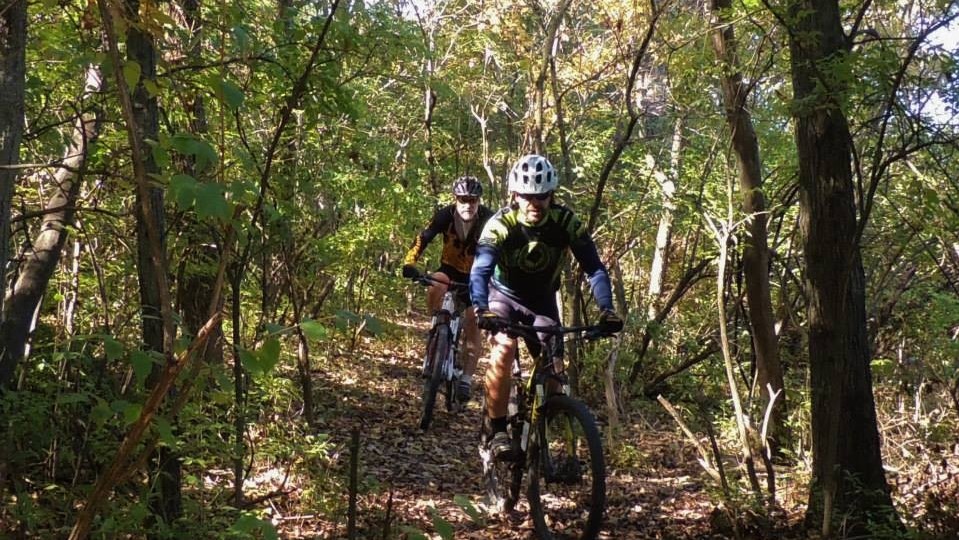
Go explore! KC Parks has miles of beautiful, natural-surface trails located on varied terrain throughout the Kansas City area. Each trail is open for hiking, trail running, and biking. Please don’t hike, run, or ride on muddy trails.
Blue River Parkway Trails
Location: Blue River Road and E Blue Ridge Blvd.
Length: 25 miles
Description: Winding up the slopes above the Blue River, this longer trail system features a variety of terrain, rock features, and river views. This system anchors one of the largest new trails projects in the city, eventually connecting to the Swope Trails system.
Categories: Hiking/Walking/Running/Mountain Biking
Surface: Natural, Concrete, Crushed Limestone
Partners: Jackson County Parks + Rec and Urban Trail Co.
Map>>
Hidden Valley Park Trail
Location: 4029 N Bellaire Ave.
Length: 4 miles
Description: The Hidden Valley Park trail skirts the rim and dives into the valley that earned the park its name. A mid-length trail, Hidden Valley has a remote feel and boasts unique, stunning views down into the valley.
Categories: Hiking/Walking/Running/Mountain Biking
Surface: Natural
Partners: Urban Trail Co.
Map>>
Hodge Park Trails
Location: 24 NE Reinking Rd.
Length: 7 miles
Description: This trail system winds through the Hodge Park grounds near the Shoal Creek Living History Museum destination. These flowing paths provide an urban escape and a perfect woodland trail experience for younger or newer trail users.
Categories: Hiking/Walking/Running/Mountain Biking
Surface: Natural
Partners: Urban Trail Co.
Map>>
Kessler Park Trails
Location: 59 Chestnut Trafficway
Length: 8 miles
Description: Highlighting the bluffs over state scenic byway Cliff Drive, this trail minutes from downtown is a highlight of the stunning Kessler Park landscape. This trail project has reclaimed land from invasive honeysuckle and misuse.
Categories: Hiking/Walking/Running/Mountain Biking
Surface: Natural
Partners: Urban Trail Co.
Map>>
Rozarks Trails/Roanoke Park Trails
Location: 3648 Roanoke Road
Length: 6 miles (Roanoke-2.5 miles; Rosedale, 3.5 miles)
Description: A singletrack experience in the urban core, connecting neighborhoods to nature and linking parks in the near northeast corridor in both Missouri and Kansas.
Categories: Hiking/Walking/Running/Mountain Biking
Surface: Natural
Partners: Urban Trail Co.
Map>>
Swope Trails
Location: Oldham Road in Swope Park
Length: 13.5 miles
Description: This longer trail system in one of KC’s crown jewel parks features gently rolling contours on its north side and limestone bluff faces to the south. The Swope Trails system represents almost a decade of work. Ongoing project phases will add mileage within the park and work to connect with the Blue River Parkway trail system.
Categories: Hiking/Walking/Running/Mountain Biking
Surface: Natural
Partners: Urban Trail Co. and Heartland Outside
Map>>
Cave Spring Park Trails
Location: 8701 E. Gregory
Length: 4.5 miles
Description: These dirt hiking trails are located at the Cave Spring Historic Site & Nature Center. There are 3 loops — but once on the trail it feels like the trails all loop and cross so much you can take a different route each trip. Along the trail you will see remains of old cabins, creeks, ponds and — of course — a small cave with a spring in it. Open daily from dawn to dusk.
Categories: Hiking/Walking
Surface: Natural
Partners: Jackson County Parks + Rec and Cave Spring Association
Map>>
Fox Hollow Trail
Location: 4601 E. Gregory in Swope Park
Length: 2 miles
Description: Located behind Lakeside Nature Center, Fox Hollow Trail is shaded by trees, vines, flowers and features rock formations and a creek crossing. It’s a hidden forest gem that makes you forget you’re still in Kansas City.
Categories: Hiking/Walking
Surface: Natural
Partners: Lakeside Nature Center
Map>>
Jerry Smith Park Trail
Location: 139th St and Prospect Ave.
Length: 1.36 miles
Description: A crushed limestone loop trail that features beautiful wild flowers and a native prairie preserve providing unusual calm close to an urban area. The park/trail close at sunset every day.
Categories: Hiking/Walking
Surface: Crushed Limestone
Partners: KC Wildlands
Map>>
Riverfront Heritage Trail
Location: Berkley Riverfront Park
Length: 15 miles
Description: A fully accessible 15-mile bicycle and pedestrian pathway that begins at the riverfront and winds through the oldest and most historic parts of bi-state Kansas City. It is the first of its kind in Downtown Kansas City. It links communities, parks, and exciting destinations with unique new venues and dramatic public artworks. Historical markers along the Trail will create a journey through the early history of this region.
Categories: Hiking/Walking/Running/Bicycling
Surface: Concrete
Partners: KC River Trails, Berkley Riverfront and PortKC
Map>>
Line Creek Trail
Location: 2699 NW 60th St.
Length: 8.25 miles
Description: Line Creek Trail winds serenely through the beautiful countryside of Platte County. In any portion of the trail you’ll find a peaceful experience waiting for you. Follow the trail through wooded areas along the creek for a back-to-nature experience in the heart of the Northland. The multi-use trail sees frequent use by hikers and bicyclists. You may also see deer, squirrels, birds, and a variety of other wildlife.
Categories: Hiking/Walking/Running/Bicycling
Surface: Concrete
Partners: Platte County Parks & Recreation, City of Kansas City and the City of Riverside
Map>>
